Route March, 7 March 1944: B Company, 2nd Parachute Battalion

Note:
The route stretches over multiple sheets of the wartime military maps of the England and Wales, One-Inch Popular Series, GSGS 3907 - 1933-43.
For clarity, a modern map has been used instead.
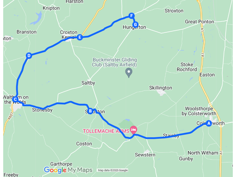
Partial map of the route march undertaken by B Company, 2nd Parachute Battalion, on 7 March 1944. (Google MyMaps, map data © 2023 Google)
On 7 March 1944, the men of B Company, 2nd Parachute Battalion, carried out a clockwise, circular route march of at least 22 miles (35.5 km) from Colsterworth, south-east of Grantham. At the time, the Battalion Headquarters was based in Millfield House, Colsterworth. The route was recorded in the Battalion’s War Diary as follows:
7th (March) 0900 ‘B’ Coy on short Pl [platoon] exercise and Route March. Route taken as follows:
Colsterworth – Buckminster 3342 – Spr[o]xton 7147 – Walton [Waltham on the Wolds] 2644 – Rd Junction 270477 – Rd Junction 305688 – Rd Junction 378503 – Crosscountry to Skillington 3545 – To Colsterworth.
Note:
- The names of Sproxton and Waltham on the Wolds were misspelt in the War Diary entry.
- The map references for the road junctions 305688 and 378503 appear to include typing errors (the underlined numbers) because there are no road junctions at these references. The correct references are likely to have been 305488 and 338503, where there are road junctions that fit logically in the flow of the route.
The War Diary entries contain insufficient information to be certain about the precise points where the route started and finished in Colsterworth; the course of the route across country from the road junction near Hungerton (marked ‘G’ on the map) to Skillington; and the precise route from Skillington to Colsterworth.
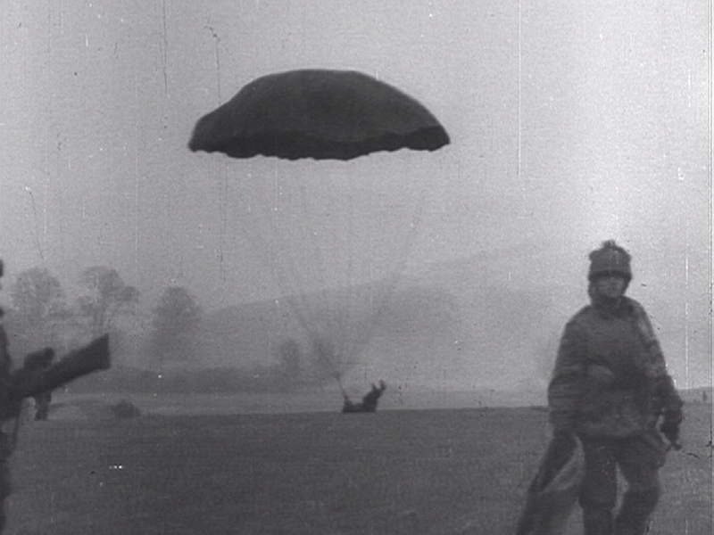
A paratrooper makes a heavy landing during an exercise. (Critical Past film 65675058877)